Battlefield Acquisition Grants Awarded to Three Civil War Battlefields

Earlier this month, the National Park Service’s American Battlefield Protection Program (ABPP) announced the awarding of $820,612.66 in Battlefield Land Acquisition Grants to three Civil War preservation projects.

The grants were awarded to state and local government agencies in North Carolina, Tennessee, and Virginia, protecting 73.21 acres of Civil War battlefields. The grants support the agencies’ ongoing partnerships with nonprofit partners to preserve the sites while also conserving open space and natural resources.

“These grants to state and local governments represent an important investment in public-private conservation efforts across America,” said NPS Director Chuck Sams. “They support partnership efforts that thoughtfully consider the needs, concerns, and priorities of communities inextricably connected to these unique places and stories.”

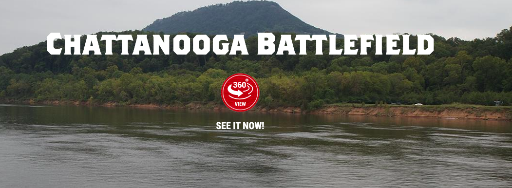
The North Carolina Department of Natural and Cultural Resources received $50,916 to preserve 15.14 acres of the Bentonville Battlefield. The City of Chattanooga, Tennessee received $353,522.19 to acquire 7.6 acres on the Chattanooga Battlefield. The Virginia Department of Conservation and Recreation were awarded $416,174.47 to save 50.47 acres of the Second Deep Bottom Battlefield.

To find out more about the National Park Service’s American Battlefield Preservation Program, visit their website.

Eisenhower National Historic Site – World War II Weekend, September 16 – 18 

GETTYSBURG, PA. – How would you have served during World War II? Army? Navy? Marine? Or home front supporter? In 1942, Americans were building our military forces, supporting our Allies with industrial and agricultural supplies, waging war across two oceans, and struggling to define freedom and citizenship at home.  


Eisenhower National Historic Site’s (NHS) 2022 World War II Weekend will take place from September 16 to 18. Park staff, living historians, and volunteers will help bring to life the ways ordinary citizens confronted these extraordinary challenges from 80 years ago. This year's event will focus on 1942, a year when millions of Americans came together to fight fascism and the Axis powers.   


The 2022 World War II Weekend will feature a keynote address by Susan Eisenhower, granddaughter of Dwight and Mamie Eisenhower, a living history encampment, family activities, and special programming at Eisenhower NHS; special exhibits in the Gettysburg National Military Park (NMP) Museum and Visitor Center; and ranger-led walking tours at the Gettysburg National Cemetery. 


World War II Weekend Schedule: 

·       Keynote Presentation: Friday, September 16 at 7 pm: Susan Eisenhower will discuss her grandfather’s leadership style and her book How Ike Led at the Gettysburg NMP Museum and Visitor Center. A book signing with Susan Eisenhower will occur following the program. Bring your own copy of one of Susan’s books or purchase one in the bookstore in the Museum and Visitor Center. Tickets are free, but reservations are required.  

·       Friday, September 16, Saturday, September 17, and Sunday, September 18 from 5 – 6 pm: Park rangers will offer guided walking tours of Gettysburg National Cemetery, exploring the stories of the 590 fallen WWII soldiers, sailors, marines, and airmen buried there. These programs will focus on stories relevant to 1942. Meet at the Taneytown Road entrance to Gettysburg National Cemetery. 

·       Saturday, September 17 from 9 am – 5 pm, and Sunday, September 18 from 9 am – 3 pm: Eisenhower NHS visitors can explore a living history encampment featuring American and Allied units. For Americans denied the opportunity to fight because of gender, age, or race; volunteers will share how the American public was encouraged to support the war on the home front. Throughout the weekend, park rangers and guest speakers will provide presentations on a variety of topics at the speaker’s tent. Park staff and living historians will also provide interactive activities at our Family Education Tent, including a special WWII Weekend Family Activity Booklet. Those completing the booklet can visit our enlistment station and earn their very own WWII style dog tag. See our website for a full schedule of programming. 

·       Saturday, September 17 from 9 am – 5 pm, and Sunday, September 18 from 9 am – 3 pm: The Naval Heritage Command Center, U.S. Museum of the Navy, and the National Museum of the Marine Corps will share special exhibits at the Gettysburg NMP Museum and Visitor Center. 

·       Tours of the Eisenhower home will also be offered throughout the weekend. 


How to visit Eisenhower National Historic Site during World War II Weekend: 

·       Shuttle buses depart every half hour from the Gettysburg National Military Park Museum and Visitor Center, located at 1195 Baltimore Pike, on both days of the event. A shuttle fee does apply. Visit the Gettysburg Foundation website or call 877-874-2478 to make reservations. 

·       Weather permitting, free on-site parking for passenger vehicles only will be available at Eisenhower NHS in a farm field accessible from Emmitsburg Rd, Business Route 15.  

·       Bus groups and visitors using wheelchairs should plan to use the shuttle system.  


Required free tickets for keynote presentation with Susan Eisenhower: 

·       Visit the Gettysburg Foundation website https://cart.gettysburgfoundation.org/21324/21325or call 877-874-2478 to make reservations.  


Full World War II Weekend event schedule: 

·       Visit the Eisenhower National Historic Site website https://www.nps.gov/eise/world-war-ii-weekend.htm for full details. 


All World War II Weekend programming is free of charge. 


www.nps.gov 

 Jason Martz, Communications Specialist

Gettysburg National Military Park & Eisenhower National Historic Site

Office - 717.338.4423

Pa.’s collection of Civil War battle flags featured in new exhibit

Civil War buffs will be able to browse Pa.’s treasured regimental flag collection in new exhibit

Battle-stained flags that survived ferocious fighting fill drawers in cabinets inside the Pennsylvania Civil War Battle Flag Education Center in Harrisburg.

Each one serves as a memento of a fight to preserve the Union and a connection to the Pennsylvanians who participated in that war. Some are in tatters; others riddled with bullet holes.

But all are treasured and conserved to the greatest extent possible for schoolchildren, Civil War enthusiasts and re-enactors and historians to see these 19th century communication tools that gave soldiers on the noisy, chaotic battlefields their direction.

CLICK HERE TO READ THE ENTIRE ARTICLE

New Underground Railroad  Statue Dedicated in York

August 15, 2022 by Leon Reed from Gettysburg Connection

Living historians (left) and politicians pose with statue [Leon Reed]

PA Governor Tom Wolf and other dignitaries gathered in front of the William Goodridge Freedom Center and Underground Railroad site in York on Friday. They were there to unveil and dedicate a monument of William Goodridge, who was born in slavery but became one of York’s leading businessmen and a major leader on the Underground Railroad. It is the first statue of a black man erected in York.

The statue was created by Gettysburg sculptor Gary Casteel. For Casteel, this was the culmination of a four year project. He first visited the site to discuss the project in July 2018 and developed the design concept shortly afterwards. “Creating a public monument is a big project and this went as smoothly as any. A lot of people have to buy-in and the money has to be raised,” he said.

In addition to honoring one of its most distinguished citizens and attracting visitors to the museum, people who sponsored the project hope it will also promote tourism.

Like his statue of Confederate General James Longstreet, located in Pitzer’s Woods along West Confederate Avenue in the Gettysburg National Military Park, Goodridge is human scale and appears at ground level. He sits invitingly on a bench, surrounded by various tools of his trades (including barber scissors and a lantern symbolizing his work with the Underground Railroad), ready to greet visitors.

”People don’t want to look at a statue on a 12 foot platform,” said Casteel. “They want to be able to interact with it, sit beside him, get a selfie.” And sure enough, the minute the ceremony ended, a line of dignitaries formed to get a photo with Mr. Goodridge.

Civil War Uniform Button Discovered At Little Bighorn Battlefield

Published on August 12, 2022August 12, 2022 in News/Good news

By Wendy Corr, Cowboy State Daily 

Just over the Wyoming-Montana border, ghostly memories haunt the plains. 

In late June of 1876, warriors of the Lakota Sioux, Northern Cheyenne and Arapaho tribes battled soldiers of the 7th Regiment of the US Cavalry on the banks of the Little Bighorn River in southeast Montana.  

The 274 soldiers who followed George Armstrong Custer into battle were killed – including Custer himself. Among the combined tribes, at least 50 perished.  

Some say their spirits still roam over the place where so many lost their lives. And sometimes, those ghostly memories become real enough to see and touch.

Infantry Cuff Button 

On Monday, three groups of visitors to the Little Bighorn Battlefield National Monument near Hardin reported an unusual find – a small button, about the size of a dime, bearing the insignia of a general infantryman from the Civil War.  

Stan McGee, Chief of Interpretation and Public Information Officer at the Little Bighorn Battlefield, said based on the button’s size, it would have been a cuff button, or sewed onto a military vest. But he said there’s no telling if it was attached to a uniform that has since been reclaimed by the elements, or if it simply fell off during the battle. 

“It’s a general enlisted man’s button,” he said, adding that the buttons were made for Civil War uniforms and were most likely made of brass. 

“It’s oxidized from being in the ground,” he said, referring to the artifact’s bluish tinge. “And you know at the time it would have been bright polished brass.” 

Civil War Connection to the Indian Wars 

McGee said that after the Civil War was over, the War Department had a surplus of buttons, along with other uniform pieces. 

“So those Civil War buttons would commonly be reissued for the Indian Wars as well,” he said, explaining the appearance of such a button on a battlefield in Montana. 

McGee, who only recently arrived in Hardin after several years at the Harper’s Ferry  

National Historic Park in West Virginia, is primarily a Civil War historian.  

“I’ve pretty much covered the Civil War, not only in my career with the Park Service, but before my career with the Park Service,” he told Cowboy State Daily. “And Civil War history just kind of segues into western Indian War history too, because a lot of those soldiers had fought during the Civil War, and a lot of them transitioned out here to the Indian Wars as well.” 

Artifacts Surface After Extreme Weather

McGee said extreme weather events, such as fires or heavy rains, can sometimes reveal artifacts hidden below the surface of the soil. 

“After those big fires back in the 1980s and early ‘90s, a lot of artifacts did pop up,” he said, adding that those were mostly spent cartridges and bullets. 

But those artifacts have helped to interpret what happened on those fateful days in 1876. 

“After those fires in ‘80, and in the ‘90s, we were able to trace battle lines through all the finds that we discovered,” he said. 

But McGee said there haven’t been any other interesting finds – until recently. 

“Nothing major has been found since the ‘90s,” he said. “But it seems just recently, some stuff is starting to pop up and be found again.” 

Doing the Right Thing 

McGee said all three of the groups that discovered the button Monday did the right thing – rather than picking up the artifact, they simply took pictures of it, then reported the sighting to park officials. 

McGee said the acting superintendent of the park, along with the park’s curator and McGee, went to the location and removed the button from the battlefield, because of its visibility. 

“If it would have been in tall grass where it wasn’t visible, we would have just left it alone,” he said, “but we were worried that maybe the fourth or fifth visitors that noticed it would have just picked it up, and put in their pocket.” 

McGee said that in his experience, moments like these are opportunities to teach the public about the rules regarding national historic sites. 

“If individuals are caught removing a historical object from federal lands, it can result in a $5,000 fine, and even up to six months in jail,” he said. “What was really cool about the one group, it was a family with a young girl, probably about the age of 12, and it was kind of like a learning moment for her, to do the right thing.” 

Conference on Civil War Medicine is Sept 30 to Oct 2

The 28th Conference on Civil War Medicine will take place from September 30 – October 2, 2022. Hosted by the National Museum of Civil War Medicine, it will be a weekend filled with exciting tours, programs, and experiences.

The Conference will begin on Friday September 30 with a reception at the Museum featuring light refreshments. At the reception, attendees will have the chance to see newly restored artifacts not on display and meet Conservator Sharon Norquest, who performed the restorations, do a tasting of Civil War inspired spirits, talk with the staff, explore the galleries, and hear exciting new updates on what’s next for the Museum.

Saturday October 1 begins with a tour to Seton Shrine in Emmitsburg, Maryland. The tour will cover how the sisters there acted as nurses during several Civil War campaigns. Then, after lunch at the Carriage House restaurant (included in the ticket price), attendees will tour the Gettysburg Foundation’s Spangler Farm and hear a presentation by Historian Ron Kirkwood, author of “Too Much for Human Endurance” about the farm’s time as a field hospital.

Sunday October 2 concludes the Conference with an exclusive guided tour of Monocacy by Author Ryan Quint and Historian and Former Director of Interpretation Jake Wynn.

Tickets are $125 for you our Museum Members! Tickets cover admission to all programs and tours, refreshments on Friday, and lunch on Saturday.

Attendees can call 301-694-7500 to reach the Clarion Inn Frederick Event Center and ask for the Civil War Medicine room block. Attendees can also reserve a room at the special rate online by clicking here.

Note there will be no bus provided for the Conference in an effort to keep ticket prices down.

Contact John Lustrea at john.lustrea@civilwarmed.org with any questions.

How Weather Changed the Course of the Civil War

From the American Battlefield Trust

Weather and climate can carry heavy consequences for humanity... whether it comes in waves, eruptions, downpours, earthquakes, tornadoes, droughts or another of Mother Nature’s many obstacles. Sometimes, these environments can set already-strained situations ablaze — like a match to a pool of gasoline. Consider the fate of Napoleon’s army as it tried to invade Russia during the winter. Or how the monsoons of Southeast Asia have dictated or derailed campaigns across that region.


This correlation held just as true during the Civil War, when great droughts, unnaturally intense rains, and atmospheric phenomena played a significant role in every theater of the war.


Climate and Resilience in The East


In the Eastern Theater, there were plenty of times that weather helped or hindered the objectives of both Union and Confederate troops. Perhaps the most infamous were the precipitation irregularities that stymied the Union army following the Battle of Fredericksburg. Chiefly, a combination of unusually heavy winter rains and poor infrastructure further demoralized the Union forces under Ambrose Burnside.


Attempting to turn over a new leaf and leave behind the disaster that had unfolded at Fredericksburg, Burnside ordered the whole army to march downriver in January 1863 to cross under the cover of a cavalry feint upstream. But heavy rains exacerbated by massive deforestation — due to soldiers burning the surrounding woods for warmth — caused the already bad roads of Central Virginia to deteriorate further. In what is remembered as “The Mud March” and “The Union’s Valley Forge,” the Army of the Potomac became hopelessly mired in mud that was supposedly so deep and thick as to have swallowed entire gun carriages and limbers of artillery.


A sketch by Alfred Waud depicts Union forces coping with the challenge of winter weather in 1863 as they advanced toward the Rappahannock River.

"Marching in the Rain, Stuck in the Mud, A Flank March across Country during a Thunderstorm" etching by Edwin Forbes (Pennsylvania State University. Special Collections Library)


Brig. Gen. Daniel Woodbury summarized the new reality: “The rain has prevented surprise, and changed our condition entirely.” With Burnside’s grand vision drowned in the muck and mire, Richmond went unchallenged and the war stretched on for three more years.


Drought and Disaster in the West


But weather doesn’t play favorites or confine itself to geographic areas. Climatic events in the Western Theater also had tactical effects that influenced the trajectory of the entire war.


La Niña, a period of cyclical cooling over the Pacific Ocean, coincided with the critical 1862 Heartland Campaign in Kentucky and Tennessee. The cooler oceanic temperatures reduced precipitation in the western and midwestern United States, leading to months of severe drought throughout Confederate territory. In part, this lack of easily sourced drinking water motivated Braxton Bragg’s army to coalesce around Perryville where, it was thought, Doctor’s Creek could provide water for his men and horses before marching northward. Maj. Gen. Don Carlos Buell and his Union Army of the Ohio responded to the Confederate movement, despite intense dehydration and sickness stemming from the conditions, and positioned themselves for a clash.


In the ensuing battle, Bragg was dealt a strategic defeat which forced him and the remaining Confederate forces back into Tennessee, setting the stage for a more consistent Union effort in the west.


Furthermore, the drought of 1862 caused enormous crop failures all throughout the south. This, combined with Union blockades preventing imports, shifting population patterns as refugees fled to cities, inflation, and the need to funnel supplies to field armies, led to widespread bread riots across the South, especially Richmond, in the spring of 1863.


The effects of climate, an actor with neither good nor ill will towards our country’s discord, played a huge role in the ending of the conflict. Though better prepared for disaster than the Union Army of 1863, we still face issues of lackluster infrastructure in the face of severe weather events, impacting both civil and military matters around the globe. It is incumbent that we remember how the Earth retains an active and unpredictable hand in the matters of war and peace.


Little Round Top rehabilitation project at Gettysburg

Auto Tour detour map

Click here for closing info for Devil’s Den and Little Round Top

GETTYSBURG PA – A $13 million rehabilitation of Little Round Top began on Tuesday, July 26 at Gettysburg National Military Park (NMP). The Little Round Top area of the battlefield will be closed for approximately 18 months while the National Park Service improves infrastructure and updates the experience for visitors.  


Results of a 2017 Gettysburg NMP Visitor Study emphasized the importance of Little Round Top to visitors. The report showed that 90% of park visitors go to Little Round Top during their battlefield visit.  


“This closure will allow the necessary improvements to be completed in a safe and timely manner. The result of this project will help prevent further damage to this iconic location while increasing access and improving the visitor experience,” Superintendent Steven D. Sims said. 


The scope of the rehabilitation project will address 1) overwhelmed parking areas and related safety hazards, 2) significant erosion caused by heavy visitation, 3) degraded vegetation, and 4) poor accessibility. The high volume of visitation is a significant contributing factor to the deterioration of the landscape, resulting in a degradation of important natural and artificial defenses, and historic topographic features of the battlefield. The rehabilitation of Little Round Top will reestablish, preserve, and protect the features that make up the battlefield landscape and that are essential to understanding the three-day battle that occurred at Gettysburg. This rehabilitation project will also enhance the experience of visiting the hill, with improved interpretive signage and new trail alignments, allowing visitors to immerse themselves into the historic landscape.   


Gettysburg National Military Park preserves, protects, and interprets the 1863 Battle of Gettysburg during the American Civil War, the Gettysburg National Cemetery, and their commemorations. The project will provide the maximum possible level of access to, and interpretation of, key battle and commemorative features, while ensuring the protection and stewardship of this highly significant site.   


Closures   


During the 18-month rehabilitation project, the following will be closed to all visitation and traffic:   

·       The entirety of Little Round Top as described as the area that borders Wheatfield Road to the north, Crawford Avenue to the west, Warren Avenue to the south, and Sykes Avenue to the east.   

·       Roads in their entirety: Sykes Avenue, Warren Avenue, Wright Avenue.   

·       Hiking trail in its entirety: The trail that runs parallel to Sykes Avenue, located on the east side of the road, from Wheatfield Road on the north end to just past Wright Avenue on the south end.   

During the rehabilitating, the following will be closed to all vehicle traffic:   

·       South Confederate Avenue will be closed to all vehicle traffic just south of the picnic area.    

·       South Confederate Avenue will be open to all pedestrian (walk, hike, bicycle, Segway) traffic from just south of the picnic area to near the four-way intersection with Warren Avenue, Sykes Avenue, and Wright Avenue. All pedestrian traffic will be required to turn around at this intersection. Walkers and hikers will also be able to proceed on the many hiking trails around Big Round Top, to Devil’s Den, and to the Slyder and Bushman farms. As always, bicyclists and Segway riders are not permitted to ride on any unpaved surface.   

Auto Tour Detour   

Due to the length of the project, and the roads affected by the closure, the park has created an updated Auto Tour detour. This map is available on our website and in paper format at the Gettysburg National Military Park Museum and Visitor Center information desk. This paper map will also be distributed throughout the Gettysburg, PA area through Destination Gettysburg and Main Street Gettysburg affiliates.   

Project Website   

The Gettysburg National Military Park website (https://www.nps.gov/gett) has a dedicated section for the Little Round Top rehabilitation project. These web pages include the Auto Tour detour map, Frequently Asked Questions (FAQs), a project timeline, links to Little Round Top virtual content, and photo albums. More content will be added as it becomes available.   

Cost   

The overall cost of the project is $13 million ($11 million for construction and $2 million for re-vegetation). The project has been funded through a mix of private and federal funding. The staff of Gettysburg National Military Park would like to thank the following: John Nau III, Gettysburg Foundation, American Battlefield Trust, and the National Park Foundation.   

We appreciate your patience as we work to complete this pivotal rehabilitation project.   

www.nps.gov  

Help Preserve Gettysburg’s Iconic Skyline

There is no more iconic battlefield than Gettysburg. Names like Devils Den, Little Round Top, the Railroad Cut and the High-water Mark have left indelible marks on each of our hearts. Many of us have visited these places on multiple occasions and have fond memories of this historic and picturesque landscape.


We know the value of preserving battlefields as walkable classrooms and places that should be protected so that future generations can share the same experiences we have had. Well, imagine if the next time you visit the battlefield the bucolic views we have come to enjoy and appreciate are now marred with a giant water tower and other 21st-century support structures.


The very essence of the Gettysburg viewshed is now being threatened by a proposed zoning amendment that could change the skyline forever.


On Tuesday, July 26 the Cumberland Township Board of Supervisors will consider a request to amend a zoning ordinance that would increase the maximum height regulations for "essential services" from 35 to 175 feet in Residential and Residential Medium High Districts. This proposed change would open the door for projects such as a recent proposal by the Gettysburg Municipal Authority to build a 175-foot water tower on historic Herr’s Ridge, creating a massive visual intrusion on the First Day portion of the battlefield and overshadowing other critical to the scenic integrity of the park.


We invite you to join us in raising concerns to the Cumberland Township Board of Supervisors about the proposed amendment. It’s essential that we make our voices heard and share our concerns with the Board.


Take a moment to SPEAK OUTsign the appropriate letter on our website to the Board of Supervisors, emphasizing the need to protect Gettysburg National Military Park’s magnificent viewshed and identify less-intrusive solutions to infrastructure goals. If you are able, please consider attending the Board of Supervisors hearing on July 26 to make your voice heard.


Don’t let Gettysburg’s skyline that we have all come to cherish be scarred forever.


Sincerely,
Jim Campi
Chief Policy and Communications Officer
American Battlefield Trust

NPS Developing Landscape Plan At Antietam

Park Service Developing Landscape Plan At Antietam National Battlefield

From National Parks Traveler
By
Compiled From NPS News Releases - July 8th, 2022

The National Park Service is preparing an updated land management plan for Antietam National Battlefield/NPS file

The National Park Service is taking a look across the landscape at Antietam National Battlefield with an eye towards restoration and preservation that would be accomplished through a Landscape Management Plan.

The agency has prepared an environmental assessment for development of the plan and is now seeking public comment on it. The plan would amend the Antietam National Battlefield General Management Plan, last updated in 1992, improve the scene restoration and resource management portions of the GMP, address lands acquired since 1992, and guide the evolving management of the historic battlefield landscape. 

The proposed project includes reforesting approximately 140 acres; enhancing riparian buffers and mitigating erosion; establishing approximately 287 acres of additional native grasslands and meadows; maintaining agricultural areas; re-planting and maintaining orchards; maintaining mown lawn; improving the Mumma Farmstead and location-specific designed landscapes; re-establishing important viewsheds; and maintaining fencing and other landscape elements.

Antietam National Battlefield was established in 1890 to commemorate the bloodiest single-day battle in American history. The purpose of Antietam National Battlefield is to preserve, protect, restore, and interpret for the benefit of the public the land and resources associated with the Battle of Antietam and its legacy. 

The purpose of the land management plan is to develop comprehensive and sustainable land-use strategies that will preserve significant landscape elements and integrate natural and cultural resources. The plan will define the framework for the treatment of the battlefield describing specific guidelines and tasks aimed to maintain and enhance its historic character. Some of the issues the updated plan will address are invasive plant species, pests, erosion of the battlefield, protection of witness trees, improving agricultural and watershed stewardship and climate change impacts. 

Public comment on the plan is being taken through August 8. To learn more about the plan and comment on-line, visit this site. You also can mail comments to:

Superintendent 
Attn: Landscape Management Plan 
Antietam National Battlefield 
P.O. Box 158 
Sharpsburg, MD 21782